Via The New York Times, an interesting report on how – through the use of tiny sensors and equipment aboard the space station – a project called ICARUS seeks to revolutionize animal tracking:
The International Space Station, orbiting some 240 miles above the planet, is about to join the effort to monitor the world’s wildlife — and to revolutionize the science of animal tracking.
A large antenna and other equipment aboard the orbiting outpost, installed by spacewalking Russian astronauts in 2018, are being tested and will become fully operational this summer. The system will relay a much wider range of data than previous tracking technologies, logging not just an animal’s location but also its physiology and environment. This will assist scientists, conservationists and others whose work requires close monitoring of wildlife on the move, and provide much more detailed information on the health of the world’s ecosystems.
The new approach, known as ICARUS — short for International Cooperation for Animal Research Using Space — will also be able to track animals across far larger areas than other technologies. At the same time, ICARUS has shrunk the size of the transmitters that the animals wear and made them far cheaper to boot.
These changes will allow researchers to track flocks of birds as they migrate over long distances, for instance, instead of monitoring only one or two birds at a time, as well as far smaller creatures, including insects. And, as climate change and habitat destruction roil the planet, ICARUS will allow biologists and wildlife managers to quickly respond to changes in where and when species migrate.
“It’s a new era of discovery,” said Walter Jetz, a professor of ecology and evolutionary biology at Yale, whose center is working with the project. “We will discover new migration paths, habitat requirements, things about species behavior that we didn’t even think about. That discovery will bring about all sorts of new questions.”
As an added bonus, people all over the world will one day be able to log on with a smartphone app to what’s known as the internet of animals to follow their favorite bird or tortoise or fish as it migrates and is tracked by the space station practically in real time.
The science of wildlife tracking, known as bio-logging, has come a long way in recent years. In the 1990s, researchers were still tracking large mammals using devices the size of lantern batteries. The technology has grown smaller since then, but many collars and tags are still too big for some three-quarters of the world’s wild creatures.
This space-based approach to uncovering the hidden lives of animals is led by Martin Wikelski, the director of migration research at the Max Planck Institute for Animal Behavior in Germany, who pursued it with a passion for years to overcome gaps and drawbacks in current technologies. It has been funded primarily by DLR, the German space agency.
ICARUS combines off-the-shelf technology, which includes solar and GPS units, and new communication technology that was developed for this mission, and specifically designed for tracking small animals.
On the ground, researchers will attach solar-powered bio-loggers that are far smaller than other technology — the size of two fingernails. They weigh less than three grams, about one-tenth of an ounce, and technicians say they will soon have one gram trackers.
Once secured — an easy process that seldom harms the animal — the sensors will hitch a ride on an array of animals and insects, like locusts, songbirds and baby tortoises. Most current wildlife tracking technologies can’t be attached to creatures that weigh less than 100 grams, or about three and a half ounces. And while the new sensors are smaller and lighter, their advanced design will allow them to collect far more data by monitoring an animal’s physiology, including skin temperature and body position, and external conditions like weather metrics.
The technology can also be used to accomplish a range of goals beyond wildlife studies.
Dr. Wikelski has studied the ability of cows, domestic goats and sheep in Italy to sense earthquakes and volcanic eruptions hours before they happen. Behavioral changes can be picked up by the sensors, he said, so herd behavior may provide an early warning.
“We think something smells wrong to them and there is static in the air,” he said. “So they move into wooded areas where they have shelter.”
Why the animals react is not yet known.
Icarus could also help track elephants vulnerable to poaching in Africa, or keep tabs on species of bats, pangolins and other animals that have played a role in viral epidemics.
“With skin temperature we can see in the ducks in China whether the next avian influenza is starting,” Dr. Wikelski said.
The power of this new approach is partially based on the fact that the space station can pick up the signals of these animals almost anywhere on the planet (the station does not pass over Earth’s polar regions, however). And while other conservation projects have tracked sharks, birds and other migratory species with satellites, this one aims to be useful for a wide range of species that researchers can ask to have added.
The sensors it relies on, at about $500 each, are a fraction of the price of other widely used tags.
They can last an animal’s lifetime and even be reused. They are able to store up to 500 megabytes, an entire lifetime of data on an animal. A researcher need not retrieve the tag; its data can be downloaded with a computer or a smartphone.
ICARUS “will truly change the study of animal migration,” said Nathan Senner, a biologist at the University of South Carolina. He plans to use it for a study tracking the Hudsonian godwit, a shorebird that makes one of the world’s longest migrations, from southern Chile to Alaska.
“We could get location estimates that are much more precise and help us develop targeted on the ground conservation measures,” Dr. Senner said.
Dr. Wikelski said he was asked by a farmer in the German village where he grew up why there were no swallows this year.
“It’s hard to say,” Dr. Wikelski said. “Did they die on the way south? Were they eaten in the Mediterranean? Were they hunted in North Africa? Were they poisoned in the Sahel? Was the weather really bad? Those are the kinds of things we will find out.”
ICARUS will provide data on an individual bird, as well as a collective. In a study by Dr. Wikelski and others at Max Planck Institute, researchers are tagging 1,200 blackbirds in the hopes of better understanding the timing and route of their travels and where and why their numbers are declining.
“No one knows how the hatchlings survive,” said Dr. Wikelski, who works with the program. “Those are the lost years of the sea turtles. Knowing where they go will allow us to protect them better.”
Because ICARUS has the capability of tagging many more animals than other technologies do, Dr. Wikelski likened it to a smartphone traffic app that can track many cars on a highway at once. One phone can provide a lot of information about one car, but many phones sending information to one app can offer information about traffic patterns.
One of the goals of the project, Dr. Wikelski said, is to help conservation managers respond to a changing world. Protected areas like wildlife parks and forest preserves are defined by fixed boundaries. But many species are on the move as climate and other changes cause shifts, and protecting them will require an understanding of where they are going and where new protected areas and corridors may need to be created.
The system will be open to researchers around the world to use for research. And the data, with some exceptions, will be accessible to everyone. Dr. Wikelski said readings from ICARUS could be combined with other kinds of information, such as the eBird database, to make the data even more robust.
Another ambition of ICARUS is to allow anyone with a smartphone to follow tagged migrating animals. One app, called Animal Tracker, already exists as a way to tap into ground-based wildlife tracking systems.
Dr. Wikelski hopes that connecting people to a single charismatic animal whose movements they can follow will build support for conservation. “If people hear Cecil the lion died it’s very real to them,” he said, referring to a lion in Zimbabwe that was killed by an American hunter in 2015. “But if you say 3,000 lions died nobody cares.”
Mark Hebblewhite, a wildlife biologist at the University of Montana who has used wildlife tracking technology for decades, said ICARUS would have the capacity to fill in many gaps in our knowledge of the natural world.
“We’ll get a lot of things from ICARUS we can’t get any other way,” he said. “It’s exciting.”
But technology has downsides as well, he said. Birds may suddenly and unpredictably change their migration, for example, after years of traveling the same way, and Dr. Hebblewhite said there was a danger that conservation decisions could be made by people “who don’t know anything about birds except dots on a map.”
Some might say nature should maintain a degree of mystery from an all-seeing eye in the sky, but Dr. Wikelski, not surprisingly, doesn’t agree.
“These animals are providing really important information, maybe for survival of humankind,” he said. “We should have this information.”
,
Read More » Posted in Satellite, Sensors | Comments Off on Scientists Use An Internet of Animals To Track and Save Wildlife
Via Terra Daily, a look at the potential for animal borne sensors to contribute to our understanding of the natural world around us:
Sharks, penguins, turtles and other seagoing species could help humans monitor the oceans by transmitting oceanographic information from electronic tags.
Thousands of marine animals are tagged for a variety of research and conservation purposes, but at present the information gathered isn’t widely used to track climate change and other shifts in the oceans.
Instead, monitoring is mostly done by research vessels, underwater drones and thousands of floating sensors that drift with the currents. However, large areas of the ocean still remain under-sampled – leaving gaps in our knowledge.
A team led by the University of Exeter says animals carrying sensors can fill many of these gaps through natural behaviour such as diving under ice, swimming in shallow water or moving against currents.
“We want to highlight the massive potential of animal-borne sensors to teach us about the oceans,” said lead author Dr David March, of Centre for Ecology and Conservation on Exeter’s Penryn Campus in Cornwall.
“This is already happening on a limited scale, but there’s scope for much more.
“We looked at 183 species – including tuna, sharks, rays, whales and flying seabirds – and the areas they are known to inhabit.
“We have processed more than 1.5 million measurements from floating sensors to identify poorly sampled areas (18.6% of the global ocean surface).”
“By comparing this with gaps in current observations by drifting profiling sensors (known as Argo floats) we identified poorly sampled areas where data from animal sensors would help fill gaps,” said Professor Brendan Godley, who leads Exeter Marine.
“These include seas near the poles (above 60+ latitude) and shallow and coastal areas where Argo profilers are at risk of hitting the land.
“The Caribbean and seas around Indonesia, as well as other semi-enclosed seas, are good examples of places where Argo profilers struggle because of these problems.”
Tagged seals in the poles have already complemented ocean observing systems because they can reach areas under ice that are inaccessible to other instruments.
The study suggests data collected by turtles or sharks could also enhance ocean monitoring in other remote and critical areas such as tropical regions, with large influence on global climate variability and weather.
The researchers say their work is a call for further collaboration between ecologists and oceanographers.
Professor Godley added: “It is important to note that animal welfare is paramount and we are only suggesting that animals that are already being tracked for ethically defensible and conservation-relevant ecological research be recruited as oceanographers. We do not advocate for animals being tracked solely for oceanography.”
,
Read More » Posted in Sensors | Comments Off on Animal Borne Sensors Could Help Humans Monitor Oceans
An announcement of an important new initiative that will help catalyze data-driven wildlife conservation by harnessing the power of technology and science to unite millions of photos from camera trap projects around the world and reveal how wildlife is faring, in near real-time:
Wildlife Insights is combining field and sensor expertise, cutting edge technology and advanced analytics to enable people everywhere to share wildlife data and better manage wildlife populations. Anyone can upload their images to the Wildlife Insights platform so that species can be automatically identified using artificial intelligence. This will save thousands of hours, freeing up more time to analyze and apply insights to conservation.
By aggregating images from around the world, Wildlife Insights is providing access to the timely data we need to effectively monitor wildlife. We are creating a community where anyone can explore images from projects around the world and leverage data at scale to influence policy.
Wildlife Insights provides the tools and technology to connect wildlife “big data” to decision makers. This full circle solution can help advance data-driven conservation action to reach our ultimate goal: recovering global wildlife populations.
,
Read More » Posted in Cloud, Google, Open Source, Sensors | Comments Off on Wildlife Insights: Data-Driven Conservation Uniting Camera Trap Projects With Artificial Intelligence
Via Space Daily, a report on a new satellite based sensor to help marine conservation:
Four tiger sharks have been tagged with a new device that will help conservationists to conduct detailed analysis of their migrations over years.
The device, developed in collaboration with ESA, is smaller and more durable than existing tags, as well as being cheaper and more animal friendly.
It records pressure – indicating the depth of the shark – temperature, light level and tilt to enable three-dimensional mapping.
The tiger sharks were tagged off the coast of Saba in the Dutch Caribbean, during an expedition organised by the Dutch Elasmobranch Society, the Saba Conservation Foundation and Nature Foundation Sint Maarten.
“It’s important to track these animals over an extended period of time, as their migratory patterns can be long and far. Ideally you want to track them for several years,” says Irene Kingma of the Dutch Elasmobranch Society.
“The potential of the new technology used in these tags is amazing as it allows us to collect more data for a longer period of time.
“As ESA has the objective to have the tags produced at a considerably lower price point than the current tags on the market, this could change the way tagging is done in the future,” she says.
The tags communicate with passing satellites. This is known as “a handshake” and takes only minimal power – about the equivalent of sending a text message from a mobile phone.
Once the first contact has been made, the information is transferred. On receiving an acknowledgment from a satellite that its data has been received, the tag stops retransmitting.
This efficiency draws less battery power, making the tag last up to five times longer than existing devices that repeatedly retransmit their information.
The smaller and lighter tag can also hold more data. In fact, once the information has been uploaded to the satellite, the tag can clear its memory and start collecting new readings.
The results so far have shown that the device is highly accurate and robust.
“This technology opens the door to brand new possibilities. Currently tiger sharks are observed infrequently and it is difficult to say where they are. We don’t know about their breeding grounds or where they go,” says Tadzio Bervoets, director of the Nature Foundation Sint Maarten, who is charge of the tagging.
“With this revolutionary new tag we are able to better determine the migratory patterns of these critically important yet threatened apex predators and enact management solutions throughout their migratory range within the Caribbean basin.”
ESA worked with AnSem in Belgium under its programme of Advanced Research in Telecommunications Systems (ARTES) to develop the Artic microchip used in the devices. It was built into a marine tag manufactured by Star Oddi in Iceland.
The tag works in conjunction with the Argos satellite monitoring system operated by CLS in France, a leading provider of satellite services for environmental and maritime applications.
“The two-way link with the satellite is the key,” says ESA’s Peter de Maagt, who was also on the expedition.
“The increased efficiency has had knock-on benefits that have opened up new opportunities for better, less invasive tracking.
“This makes it easier to monitor how wildlife is coping in our fast-changing environment.”
,
Read More » Posted in Satellite, Sensors | Comments Off on Satellite-Connected Tags Set To Boost Marine Conservation
Someday we’ll have an Internet of Fish. Underwater sensors, robots and cameras will reveal sea creatures to catch and avoid, changing ocean conditions and goings-on in farmed fish pens — all at the tap of an app. Someday we won’t stare at the seafood counter wondering if a “halibut” is really a halibut and where it came from. Someday methane-eating bacteria will clean the atmosphere and produce fish feed ingredients in the process.
That day is on the horizon — and you don’t even have to squint.
The information technology and biotech revolutions were slow to reach the over $390 billion global seafood industry, but now they are surging in to join an upwelling of technological innovation within the industry, from land-based fish farming to deep-sea fishing. Seatech, with its potential to address urgent needs such as climate change adaptation, supply chain transparency and sustainable fishing and aquaculture, promises to be at least as big an opportunity as the agtech wave that preceded it.
The Internet of Fish comes together
It’s been clear for a while that an Internet of Fish could bring all kinds of benefits, including better fisheries management, more productive and lower-waste fishing and traceable fish consumers can feel good about. But only recently has connecting all the elements of seafood’s supply chain — under the water, on the water and on shore — emerged as a realistic goal. Just 10 years ago, underwater cameras were super expensive, and refining other electronics for underwater operation wasn’t a priority. Now rafts of submersible robots, cameras and sensors are sending critical data to phones and computers on boats and on land, allowing real-time decision making.
The robots patrol open-ocean fish farms (PDF), recording the health, size and feeding habits of fish within the net pens, along with environmental conditions. They can even fix frayed nets and remove waste. Cameras in net pens and onshore aquaculture tanks keep an electronic eye out for potential problems so farmers can take preventive steps, while cameras on fishing gear let fishers see what’s in the water before they drop their nets. That helps them avoid bycatch and keep fisheries open.
Tools that gather big data from wide swaths of the ocean can make targeted fishing even more effective. The National Oceanic and Atmospheric Administration’s EcoCast tool, for example, draws on-location reports and satellite measurements of ocean conditions to show West Coast fishers where they are most likely to find swordfish and least likely to snag turtles and other threatened species. The key is making the data available in real time so that fishing boats can use it on the water.
Fish farmers are also benefiting from new data-sharing tools. NOAA’s National AquaMapper collects over 100 aquaculture-relevant geospatial data types in a web-based tool for exploring, siting and permitting offshore aquaculture operations. The tool can spare farmers months of back-and-forth paperwork with multiple agencies.
Putting the ‘see’ in seafood’s supply chain
Storied seafood has been on the industry’s menu for some time. Forward thinkers realize people who care about how their coffee got to their cup also want to know how their seafood ended up on their plate. Consumer-facing companies that work directly with fishers and farmers already can tell that story, but they’re a tiny portion of the market. For the industry at large, seeing through seafood’s more typically long, murky supply chains has been a challenge.
A whole suite of traceability and transparency technologies (PDF) is poised to change that. Companies developing these tools are small-scale at this point, but the sheer number and diversity of technologies popping up shows it is possible for seafood buyers to track where a fish was caught, the dock it was hauled up on, the temperature it’s been kept at and other meaningful data. ThisFish(a former Fish 2.0 finalist), for example, traces seafood on its journey from water to table using software that lets each handler in the chain upload information on each coded fish. The system operates in Canada’s east and west coast fisheries.
Portugal-based Bitcliq (another Fish 2.0 alumnus) is using a blockchain platform to trace fish from catch to dock. It’s also connecting fishing fleets with retail buyers, enabling on-the-spot purchases. Blockchain proponents think the shared digital ledger, which shows a cryptographically protected, time-stamped history of data uploads and transactions, has the potential to transform seafood supply chains worldwide. In addition to providing traceability, blockchain technology could make seafood trade financing viable: With reliable supply chain information and a range of blockchain solutions available, financial institutions could build better predictive models and develop finance and insurance products matched to the seafood industry’s real risks and needs.
Hooking up automated data capture solutions incorporated in packaging to Internet of Fish data coming from the water will be central to advancing blockchain adoption and other traceability solutions. Data capture by sensors, robots, computer vision and IoT systems overrides the problem of human error (or intentional fraud) in supply chain reporting, and expands the types of data available. In the aquaculture industry, big companies such as Amazon and Cargill are already starting to digitalize the salmon feed supply chain to trace feed sources.
The convergence of traceability and transparency technologies will open a path to real progress on issues such as mislabeling, illegal fishing and labor violations by revealing a full picture of seafood’s fragmented supply chain. The links — small fishing boats and farms, an array of middlemen, international retailers — still will be there, but they’ll be easy to find and connect. As with the web after Google, suddenly we’ll have everything at our fingertips.
Let them eat flies — and bacterial proteins and algae
Better fisheries management and supply chain transparency can only do so much. Aquaculture could relieve the pressure on wild fish stocks while providing good, clean protein to a world increasingly hungry for it — but only if we stop feeding farmed fish with wild forage fish. Advances in biotech could provide the answer here.
Biotech startups focused on algae, bacteria-powered waste solutions and insect proteins target the fish feed market (PDF) because it’s where low-volume production of new nutrients has the highest payoff and market demand. Oil from microalgae is an excellent, scalable fish oil alternative that delivers better animal health and growth rates than vegetable feeds, as well as better tasting, more nutritious fish.
And companies that feed methane, carbon and other industrial byproducts to bacteria in fermentation tanks are pulling out high-quality proteins that rival those in the best fish meals. Black soldier flies and other fast-growing insects that eat food waste also could be an excellent protein source for fish feeds.
Collaboration, not competition, is powering seatech’s rise
Big picture: All these technologies are potentially game-changing innovations for oceans and the seafood sector. But counter to the narrative of cutthroat competition that clings to tech generally, seatech likely will succeed only through combination and collaboration. The market is huge and these are not standalone solutions — they’re specialized pieces of a vast global whole where solutions were needed yesterday.
Growing companies are changing their priorities in recognition of this fact. More than half the companies coming into the Fish 2.0 network seek partnerships alongside investment. We started Fish 2.0 as a competition, but we’ve seen that growth in the sector depends on collaboration. Seatech’s success will lie in solving this equation: the right product plus the right business model plus the right partnerships. The result will be strong returns plus deep positive impact — and that’s a someday we can truly look forward to.
,
Read More » Posted in Sensors, Water | Comments Off on The Rise of SeaTech: An Internet of Fish
Courtesy of Nature, an article on how sharing big data from satellite imagery and other Earth observations across Asia, the Middle East, and east Africa is key to sustainability:
The ancient Silk Road trade routes connecting Asia, Europe and Africa lay behind the development of many great civilizations. Today, solar panels and smartphones have replaced silk, and trains and aeroplanes have superseded camels. But the Silk Road spirit of peace, mutual benefit and learning has been revived in an ambitious plan to bridge East and West, launched in 2013 by Chinese President Xi Jinping.
The ‘Belt and Road’ initiative promises more than US$1 trillion of Chinese investment in some 60 countries (see ‘Belt and Road’). All other nations are welcome to join in. The main aim is socio-economic development through improving the routes for land and sea trade. The initiative will also boost science and technology across the region, for example through research into artificial intelligence, nanotechnology, quantum computing and smart cities (see go.nature.com/2mvfec6).
But protecting the environment while supporting economic growth will be challenging. The Belt and Road region is home to more than 65% of the world’s population. It includes 18 cities that have populations of greater than 10 million, such as Beijing, Cairo, Moscow, Manila and Istanbul.
Environments are diverse and fragile. Conditions range from the snow, ice and permafrost of the Qinghai–Tibet Plateau to the forests and steppes of Russia and the deserts of Mongolia. Coasts and seas are threatened by rising sea levels, overfishing and pollution. Access to water is a big problem across central Asia. For example, the volume of water in the Aral Sea has shrunk by around 90% in the past 50 years, mainly because the sea and its rivers have been tapped for irrigation.
World Heritage Sites designated by the United Nations Educational, Scientific and Cultural Organization (UNESCO) are endangered by construction, logging, overexploitation and climate change. These include Sumatra’s tropical rainforests; Uzbekistan’s historic centre of Shakhrisyabz; and the world’s second-largest raised coral atoll, in the Solomon Islands at the eastern end of Rennell Island.
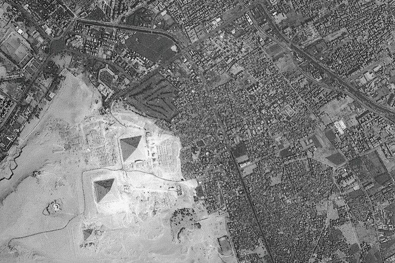
Development encroaches on the pyramids at Giza.Credit: ESA
The economies of many developing countries are rural, with agriculture accounting for more than 25% of gross domestic product. Often, more than 40% of a developing country’s workforce is involved in farming. Food supplies can be unreliable.
Natural hazards are another threat. Belt and Road nations experience about 85% of the world’s major earthquakes, tsunamis, typhoons, floods, droughts and heatwaves. For example, more than 86,000 people were killed or reported as missing in a massive earthquake in Wenchuan, China, in May 2008. And the 2004 Indian Ocean earthquake and tsunami killed hundreds of thousands of people. Seven of the top ten countries that saw major losses from disasters between 1995 and 2014 are in this region.
If we do nothing, sensitive environments will be lost and exposure to risks will rise.
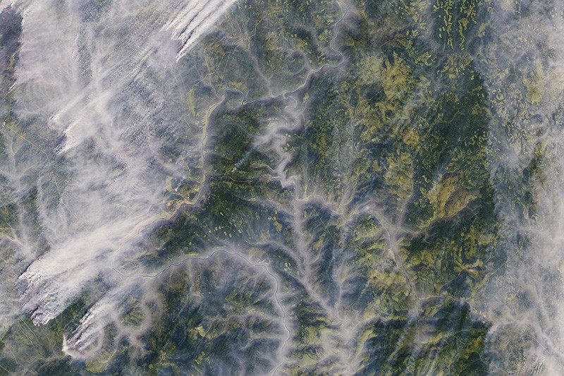
Wildfires threaten boreal forests in Russia.Credit: ESA
To address these problems, a combination of accurate, reliable and timely scientific observations of the state of terrestrial and marine ecosystems is essential — from space, the air and on the ground. However, coverage and infrastructure are poor. Many countries cannot afford to train experts in Earth-observing techniques or install ground stations to monitor soil nutrients or air quality. For example, Kyrgyzstan, Tajikistan, Turkmenistan and Uzbekistan have no Earth-observing satellites or facilities for mass data processing. Local data are rarely shared and are often locked away in government or university archives.
I chair the Digital Belt and Road Program (DBAR) initiated in 2016 by Chinese scientists in cooperation with experts from 19 countries and 7 international organizations. Our aim is to improve environmental monitoring, promote data sharing and support policymaking using big data on Earth observations. The Chinese Academy of Sciences (CAS) is investing more than 200 million yuan (US$32 million) in the next 5 years to support DBAR.
The programme will monitor different types of ecosystem and their evolution, including grasslands, forests, glaciers, urban areas, farmland and coastal regions. Environmental and socio-economic information will be shared through a platform for big Earth data, scheduled for roll-out between 2016 and 2026. This open-access gateway will allow researchers, policymakers and the public to track changes, development and trends. The programme will investigate indices and indicators to feed into the UN’s 2030 Sustainable Development Goals.
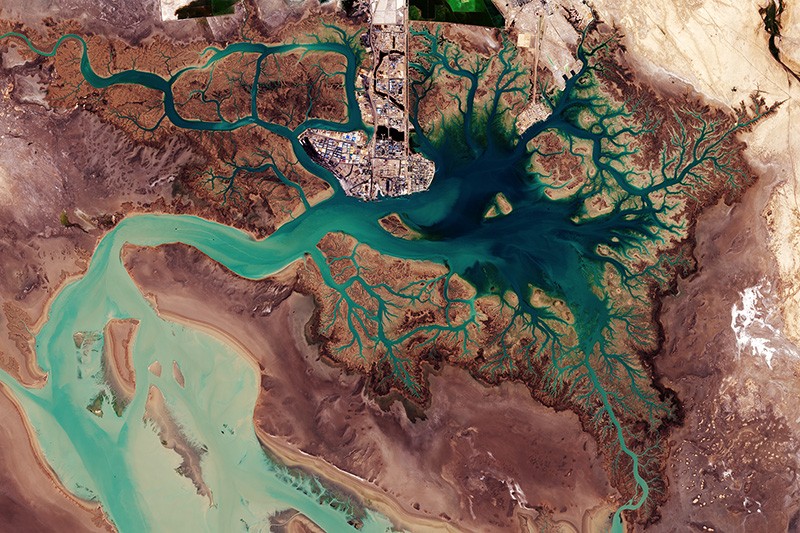
Musa Bay in Iran faces ecological damage from shipping.Credit: ESA
There are four main obstacles to a strategy on big Earth data for the Belt and Road region: poor access to data; a digital divide between developed and developing countries; a lack of awareness among some policymakers, local scientists and practitioners of the potential of Earth observations; and too little collaboration. These are long-standing problems — they also slowed emergency responses during and after the Indian Ocean tsunami in 2004, for example.
DBAR’s main approach is to work towards a platform that can handle a wide variety of information. Data sets and infrastructure are being assembled, and services should start to become available by the end of 2018. Eight key challenges are being targeted: adapting to climate and environmental change; mitigating disaster risk; managing water supplies; increasing agriculture and food security; protecting natural and cultural heritage; sustainable development of urban areas and infrastructure; managing coasts and marine areas; and understanding changes in high mountains and the Arctic.
For example, in agriculture, the main difficulty faced by most food-insecure countries of the region is a lack of up-to-date information about the supplies, yields and management of crops. DBAR is expanding the cloud-computing-based system CropWatch for monitoring and managing the availability of maize (corn), rice, wheat and soya-bean products. Launched by CAS in 1998, CropWatch provides users from 143 countries or regions with easy access to agricultural information.
For disaster relief and risk reduction, DBAR is developing a platform for sharing Earth-observation imagery. The value of such information in quickly assessing the impacts of extreme events has been proved in China and developed countries, and needs to be opened to others. For example, following the 2008 Wenchuan earthquake, Chinese rescuers were alerted to 700 people trapped in a village after seeing aerial imagery of “SOS700” written on top of a building.
The processes that shape urbanization need to be understood. Earth observations can reveal trends in the growth of cities and help planners to overcome traffic congestion, energy shortages, urban sprawl and poor basic services. For example, DBAR scientists are modelling the growth of Moscow to inform development in Beijing. The programme is also monitoring the impacts of some big infrastructure projects, including the Mombasa–Nairobi Standard Gauge Railway, Colombo Port City and the Malaysia–China Kuantan Industrial Park.
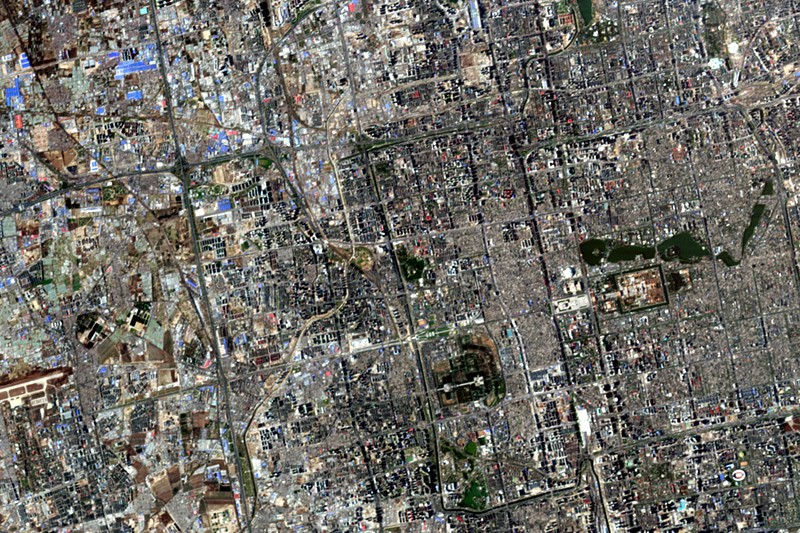
Beijing’s urban development can be tracked from space.Credit: ESA
The entire landscapes of World Heritage Sites — including human influences — need to be protected, not just their monuments2. For example, at Angkor in Cambodia, Earth observations that included airborne laser scans revealed the remains of multiple cities aged 900 to 1,400 years old lying beneath the tropical forest floor3. Deforestation and urban sprawl are the main risks that should inform a broader management strategy.
Way forward
We plan to focus on five priority areas at DBAR.
Enhance infrastructure. An open platform with shared data, codes and algorithms is urgently needed for analysing the vast amounts of Earth-observation data, which are already daunting and will only increase. The European Space Agency’s Sentinel-5P satellite, launched in October 2017, takes 20 million observations of air pollutants and gases each day — 10 times more than previous missions. Cloud computing must therefore be core4. It would currently take 1,200 years for one computer to process 3 million planetary-scale satellite scenes; a cloud-computing facility could do it in 45 days5. Earth-observing satellite data from upcoming missions will need to be incorporated.
Promote data sharing and interoperability. Data need to be openly exchanged if everyone in the region is to benefit. This will require decisions about suitable formats, information and support for handling them, as well as methodologies and tools to maximize exploitation of the data.
Extend applications to more people. Development across the Belt and Road region is uneven. To close these gaps, it is necessary to improve common solutions provided by big Earth data6. Access to tools such as CropWatch needs to be extended. Use of the digital cloud can allow anyone to access services anywhere across the region, and to accelerate the development of applications for various users.
Identify research opportunities. Knowledge could be discovered within the huge multidisciplinary data sets. For example, studying changes in the land surface of the Yellow River Delta from space over the past 40 years has increased our understanding of how its evolution depends on land use, precipitation and water flows. Researchers must help to raise awareness of the scientific potential and solutions provided by big Earth data, especially in less-developed countries.
To help bridge the technical divides between richer and poorer nations, DBAR should set up joint programmes, laboratories and international centres of excellence for gathering experts from participating countries. The programme has already established eight centres of excellence, in Pakistan, Thailand, Finland, Italy, Russia, Morocco, Zambia and the United States.
DBAR has embarked on an ambitious journey to build a digital Silk Road for sustainable development — we invite even more natural and social scientists to join this shared endeavour.
New technical innovations such as location-tracking devices, GPS and satellite communications, remote sensors, laser-imaging technologies, light detection and ranging” (LIDAR) sensing, high-resolution satellite imagery, digital mapping, advanced statistical analytical software and even biotechnology and synthetic biology are revolutionizing conservation in two key ways: first, by revealing the state of our world in unprecedented detail; and, second, by making available more data to more people in more places. The mission of this blog is to track these technical innovations that may give conservation the chance – for the first time – to keep up with, and even get ahead of, the planet’s most intractable environmental challenges. It will also examine the unintended consequences and moral hazards that the use of these new tools may cause.Read More