Via Motherboard, a look at how smart lakes and smart forests are helping researchers understand how we’re impacting nature:
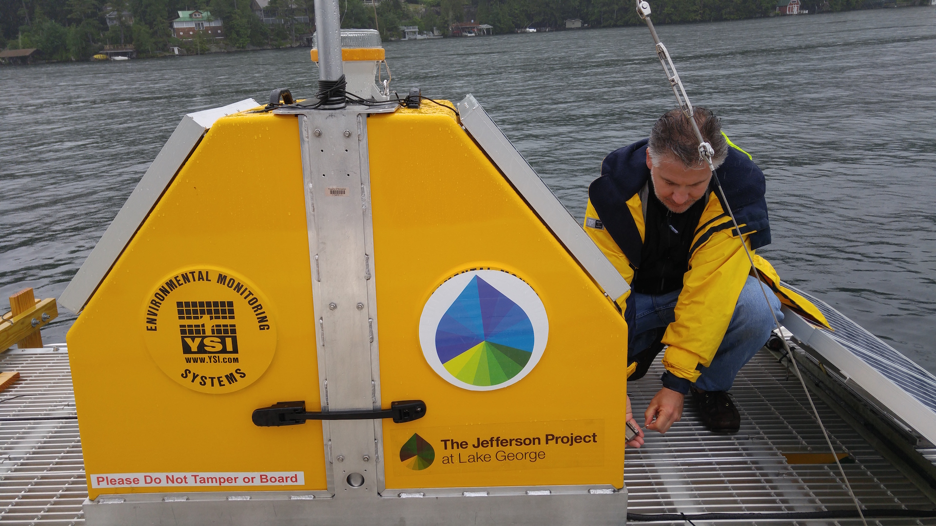
A bright yellow platform the size of a jet ski bobbed on Lake George as IBM research engineer Mike Kelly climbed aboard. Unlike the other tourists at the popular vacation spot in upstate New York, Kelly wasn’t there for a break; he was checking on sensors that transform the waterway into a “smart lake.”
The sensor rig he’d boarded was monitoring pollution, including road salt. Thick cakes of salt dumped on upper New York roads during snowstorms inevitably wash into Lake George each spring with the snowmelt, encouraging the proliferation of invasive species and making the otherwise strikingly clear waters dark and murky.
Kelly popped open a panel to show me the pulley that sends sensors into the depths of the lake. A mechanism inside was set to drop the sensors deep into the lake at the top of each hour, and reel them back in. Soon after he opened the panel, a pulley system began whirring like the spool of a mechanized fishing rod. The wire holding the sensors slid through a one-foot-wide hole in the platform’s metal grating, and I looked into the suede-blue water, wondering what types of life were getting scanned 200 feet below my soggy shoes.
IBM researcher Mike Kelly opens a panel on a floating sensor unit that make Lake George a “smart lake.” Image: Meredith Rutland Bauer
Lake George isn’t the only natural spot to get a technological upgrade. Forests are also being put under the microscope to see how they develop at Harvard Forest, a sensor-laden forest monitored by Harvard University. Oregon State University analyze songbirds’ chirping, treating certain noises as a “canary in a coal mine” for larger ecological issues.
That type of technology is helpful for developed cities to better manage their natural resources, but it could be life-saving for developing regions where data on water quality is less reliable. Harry Kolar, a researcher at IBM, said the long-term vision is to sell some of these sensor units to NGOs and researchers in developing nations so they can have the data to begin addressing those problems. It will only become a bigger issue as climate change reduces the world’s available clean water.
“Managing resources such as water quality in general is becoming a bigger problem across the world and has been for a while,” he said.
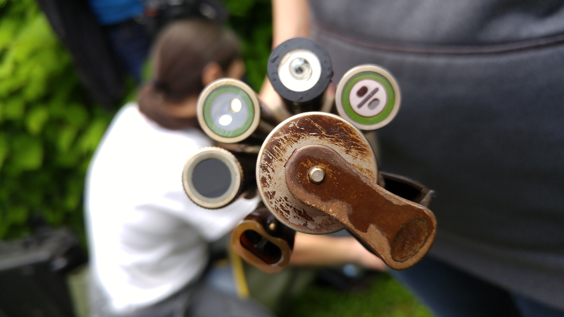
This type of aquatic sensor is suspended under the floating platform on Lake George and submerged once every hour. Image: Meredith Rutland Bauer
At Lake George, aquatic sensors are automatically dipped into the lake every hour to take measurements, including oxygen levels, pH, and salinity. They stay on the lake throughout most of the year (except when the lake freezes over in the winter) as part of the Jefferson Project at Lake George, a research collaboration between Rensselaer Polytechnic Institute, IBM, and The FUND for Lake George.
ADVERTISEMENT
Larry Eichler of RPI, a university in upstate New York, has been studying the lake for decades. He told me these sensors, the first of which was put on the lake in March, collect as much data in a week as he collected in 30 years of taking data by hand. Three rigs have installed 265 sensors on the lake, including one platform with sensors researchers can talk to in real-time, rather than having to pre-program. And if they pick up something interesting, such as a spike in a pollutant, they’re programmed to do additional scans automatically.
Eventually, the researchers said the sensors will be able to send an email or text message to researchers, water plant operators, and city officials in the event of a major issue, such as a toxic algae bloom or a hazardous waste spill. All of that better informs experiments—and in theory could advise local legislation.
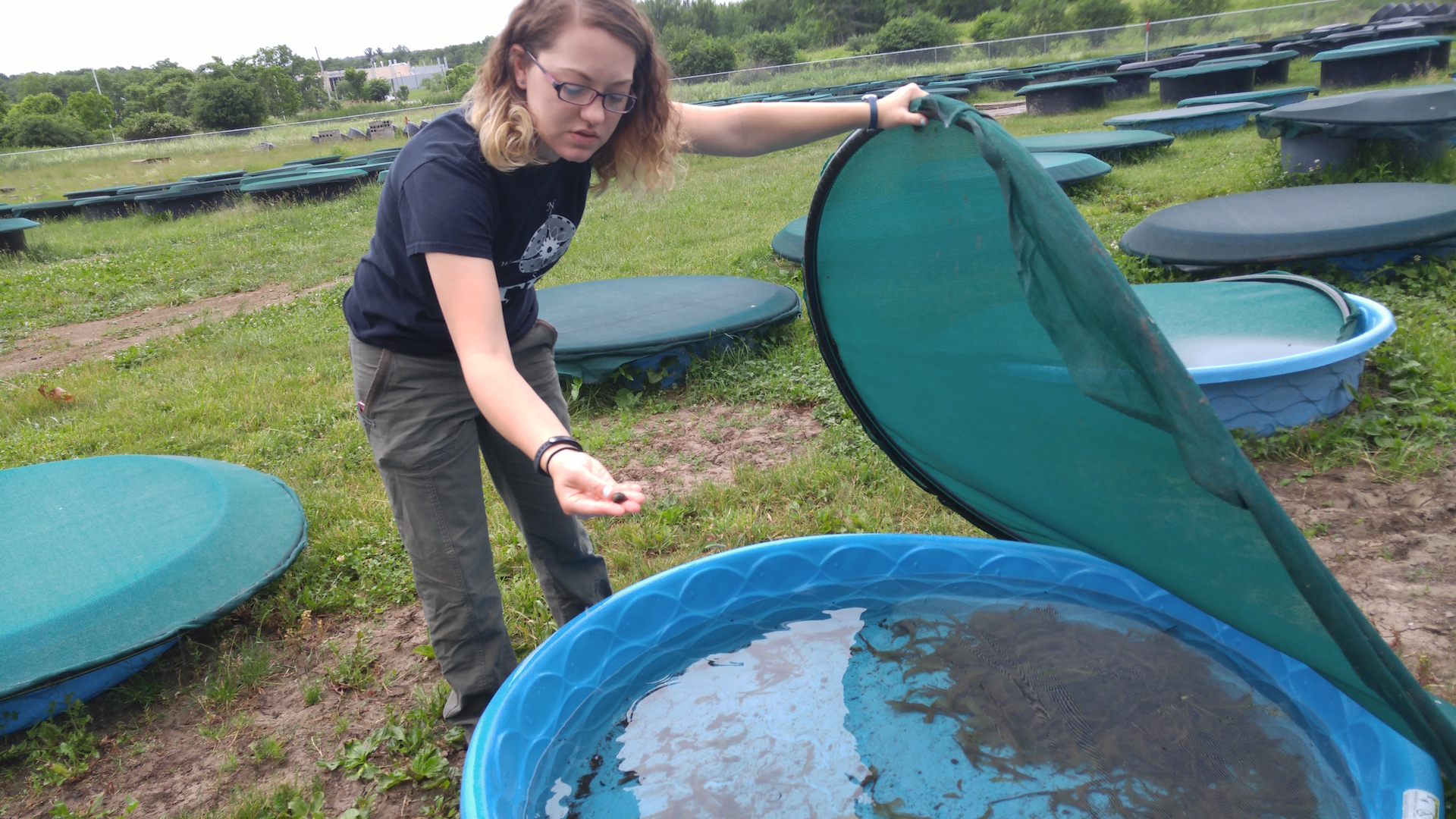
Kayla Coldsnow, RPI Ph.D biology student, holds a snail from an experiment on Lake George water quality. Image: Meredith Rutland Bauer
On another rainy day in upstate New York, RPI professor Rick Relyea led me to a field full of neon-blue plastic kiddie pools and black cattle troughs. Inside the 400 or so containers were water from the lake, plus nearly every species of plant and animal that live in the lake.
This is the end stage of the smart lake experiment, part of the Jefferson Project. It collects data, modeling software predicts problems, and the kiddie pools serve as tiny lakes for experimental confirmation. “Here we can tell you what the future will be,” Relyea said.
ADVERTISEMENT
The sensors are picking up more salt and more invasive snails? Throw that type of salt and those species into a pool with lake water and see what happens. (The calcium in one type of road salt, calcium chloride, helps invasive snails build shells easier, helping them take over.)
And if a city wants to try out a new type of road salt, they can test it here to make sure it isn’t going to cause the water to go murky or the fish to die, avoiding lost tourism dollars, crashing housing prices and boatloads of lawsuits.
As for Lake George’s future, data could protect its beauty and thriving ecosystem.
“It’s not too far gone,” Relyea said. “Changes can be made to turn it around if those changes are informed by science.”
,
Read More » Posted in Blog | Comments Off on Take a Dip Into the Internet of Lakes
Via The Source, an interesting article on the use of satellite remote sensing techniques to assess changes in water quality:
Satellites have a long history, with the American writer, Edward Everett Hale, writing speculative fiction containing the first known depiction of an artificial satellite to measure longitude in The Brick Moon, back in 1869. During the intensity of World War II, the first space-based picture of Earth was taken, demonstrating the potential for space-based cameras to help us monitor our changing world. Soon after, space became the battlefield where the US and the Soviet Union tested their supremacy during the Cold War, giving way to, amongst others, the first commercial communications satellite. Today, from atmospheric satellites that can predict weather conditions to remote sensing satellites that monitor our environment’s resources from afar, there’s little on Earth’s surface that escapes from satellites’ sight. How can we apply satellite information to improve the quality of our waters and optimise decision making in water supply services?
Our freshwater resources are severely affected by climate change, urbanisation, population growth, and competing demands from other uses, such as ecosystem protection, agriculture, energy production and recreation. Water utilities’ treatment operations, costs, and the resulting services to consumers are heavily determined by both the quantity and quality of water upstream in the catchments and reservoirs.
Changes in climate are resulting in increased frequency and intensity of precipitation, topping up reservoirs, which can result in excess water runoff. This may lead to flooding and even destruction of the water stored, compromising water supplies.
Increased urbanisation also aggravates the quality of water bodies. The expansion of paved areas and increased urban runoff are major sources of water pollution in urban areas. Another big threat to water quality comes from diffuse pollution caused by intensive farming and its associated use of pesticides and fertilisers to feed an increasing population worldwide.
These increasing pressures pose additional challenges to water utilities, many of which already struggle to secure a reliable supply of safe and clean water. Having access to real-time and forecasted information about the conditions of water quality and quantity is essential to proactively manage upstream risks, improve responses to water incidents, or improve their operational efficiency and quality of their services.
SPACE-O integrates Earth Observations and in-situ monitoring with advanced hydrological, water quality models and ICT tools, into a powerful decision support system that will generate up-to-the-minute data, as well as forecasting of water flows and water quality data in reservoirs. This knowledge about the conditions in the ground, now and in the near future, will help optimise water treatment plant operations, and increase the responsiveness of water managers against incidences, such as algal blooms, droughts and floods.
“High resolution pictures from earth observation could assist our water company in knowing when it’s the best time to take water from the river when the water stored during winter isn’t enough to supply for the summer months, highly reducing our maintenance costs,” said Ingrid Keupers, Technical Director of De Watergroep, during one of the first project consultation meetings with water utility operators.
Ensuring uptake of the resulting products is indeed crucial to the philosophy of SPACE-O. The products are centered around a decision support system (DSS) which aims to make use of satellite date and other technical tools to help water operators make informed decisions around issues such as water quality in reservoirs. From the start, a series of consultations with utility operators has been undertaken to cater the products to users’ needs. This creates ownership and interest in application of the relevant tools to their operations. Utilities that are interested to learn more can contact info@space-o.eu, and follow all the latest developments on the project’s website and social media channels.
Via Quartz, an interesting article on a “Pokemon Go” game based on the movements of real animals that directs in-app purchases towards conservation:
Over the course of five months, Manyara, a 26-year-old elephant in Tanzania, traveled 695 kilometers with her herd of elephants. They stayed close to a river, but occasionally strayed into areas close to human settlements and once crossed a highway in search of more acacia trees. A lone wildebeest named Neatoo in Kenya traversed more than 3,000 kilometers in one month in search of fresh grass. Two lions, a pair of sisters looking after six teenage cubs, traveled entirely at night, staying close to each other 90% of the time.
National parks and conservationists rely on GPS data to understand the resource needs and patterns of animals living in the wild. Now, that data is going into a mobile game where players track animals, based on their natural movements, in their own cities. In the augmented reality game, Safari Central, players follow real animals like Manyara or Neatoo. In-app purchases go towards conservation projects for those animals.
“Think of it as Pokemon Go, but where the animals are real animals, and where they move around a city based on their actual movements, not where we tell them to go,” says Gautam Shah, founder of Internet of Elephants, a US and Kenya-based start up, making Safari Central.
Shah says the game is the first to use real tracking data. They have data on elephants, lions, grizzly bears, jaguars, wolves, giant anteaters, frigate birds, vultures and other animals from organizations like WWF Brazil, Conservation International in the US, the Chicago Zoological Society, as well as conservation groups and parks based in Kenya and South Africa.
The goal is to connect more people with the daily lives of animals and raise support for conservation efforts. “Conventional fundraising approaches are not reaching enough people or raising enough funds to turn the tide,” the company said in a press release. African forest elephants, for example, will need 100 years to recover losses in the species over just the last decade.
Players track real animals in the augmented reality mobile game, Safari Central. (Internet of Elephants)Mobile game Safari Central uses GPS data from real animals. (Internet of Elephants)
The startup, which is currently holding a Kickstarter campaign to raise funds for the game, plans to release a preview of the app in August and a full launch in December of 2018.
Shah is exploring other ways to gamify the data. The movement of the animals can act as a randomizer, dictating what happens in the game, in the same way a roll of the dice affects a game like Monopoly or Settlers of Catan. “This is just the first game. There are many other ways that the data can be used,” Shah says.
,
Read More » Posted in Blog | Comments Off on The Internet of Elephants
Via Raconteur, an interesting look at how mobilizing a global citizens’ watch over the oceans is helping to combat the crime of illegal fishing:
Fishing is not the obvious focus for a major project that features both a Hollywood star and the world’s most valuable brand. However, this is not just a tale about food – this is a modern-day, global crime story.
Fish stocks worldwide are getting squeezed by legitimate operations, but also illegal activity, explains Toby Middleton, programme director of the Marine Stewardship Council. “Globally, about a third of fish stocks are overfished,” he says. “But stocks fished to their sustainable limit have steadily increased over the past 15 years from 47 per cent to 58 per cent. However, between 11 and 26 million tonnes of fish are illegally caught every year.”
In response, September last year saw Leonardo DiCaprio and then-US Secretary of State John Kerry officially launch Global Fishing Watch. The platform provides a digital tool powered by Google that adds more than 22 million data points daily to help track fleets, and expose rogue and illegal activity harmful to ocean biodiversity and marine ecosystems.
GLOBAL COLLABORATION
The information is free to browse and available to anyone with an internet connection, from governments and NGOs, through fisheries, seafood suppliers and buyers, to journalists and private individuals anywhere around the world.
The input of activists, campaigners and other citizens concerned about overfishing is directly encouraged and enabled; in effect, the crowd is invited to help police the problem.
The most important element of success for the project among all our partnerships and stakeholders is a common goal of promoting transparency at sea
Fundamentally, though, it is not the technology itself that is unique, but the mix of partners in collaboration. Global Fishing Watch harnesses the technological muscle of digital mapping and big data in support of advocacy. It brings together expertise in satellite imagery and remote sensing from SkyTruth, with the internet and cloud platform capabilities of Google, plus the campaigning focus of Oceana, an international group formed to protect oceans. Funding partners include the Leonardo DiCaprio Foundation and Bloomberg Philanthropies.
Governments also have a key role to play in the project, not just with their political endorsement, but their data. Earlier this month, both Peru and Indonesia committed to publishing government-owned vessel tracking data on the platform, taking major steps towards fishing transparency.
Despite the complexity of managing such a multi-stakeholder project, however, the metrics of its success remain relatively simple, says Jacqueline Savitz, Oceana’s senior vice president for US oceans and Global Fishing Watch. “The success of Global Fishing Watch is best measured by the impacts it creates, impacts like assisting in getting a vessel fined for fishing illegally in a protected area or convincing a local community to protect its areas from encroaching fleets,” she says.
It is all about getting eyes on the problem, concludes Ms Savitz: “The most important element of success for the project among all our partnerships and stakeholders is a common goal of promoting transparency at sea. To restore fisheries and address problems like illegal fishing and overfishing, activities at sea need to be visible; the global community needs to see what is actually happening beyond the horizon. Only then can we effectively protect our oceans.”
Via Vanderbilt University, a report on the use of ballistic shockwave sensors to help combat poaching:
Kenyan elephants will get more protection from poachers thanks to new Vanderbilt University technology embedded in their tracking collars — ballistic shockwave sensors that send coordinates to authorities immediately after detecting gunshots.
The new system is the first use of shockwave detection technology in the intensified push to thwart illegal trafficking and save endangered African elephants.
Dubbed WIPER, the project is a joint effort between Vanderbilt computer engineering faculty and Colorado State University, which has used GPS in tracking collars for years to study and protect elephants, slaughtered by the thousands for their ivory tusks.
Elephant poachers routinely use devices to muzzle the sound from their high-powered weapons, but the blast also produces an acoustic shockwave, which cannot be suppressed. WIPER technology detects that a bullet flew by a protected elephant and sends an alarm with its location.
The slaughter of elephants and other iconic African animals is fueled by rising demand for ivory in parts of the Far East. As demand increases, prices skyrocket and make illegal trafficking a lucrative, if risky, option. Save the Elephants estimates that 100,000 elephants were killed for their tusks between 2010 and 2012 alone as poaching efforts migrated from the Central African forests to East Africa.Vanderbilt University Professor of Computer Engineering Akos Ledeczi teamed up with George Wittemyer of Colorado State University, who is also chairman of the scientific board of Save the Elephants. The Kenya-based organization has collared more than 1,000 elephants.
Ledeczi’s expertise is in acoustic shooter detection, localization and classification. He and his team have received major grants from DARPA and built multiple wireless sensor nodes to detect and locate the source of gunfire.
WIPER got a significant boost June 7 with announcement of a $200,000 grant from the Vodafone Americas Foundation. The technology placed second out of eight finalists in Vodafone’s annual Wireless Innovation Project. The awards were announced as part of the 2017 Social Innovation Summit in Chicago.
“Our aim is to make WIPER open-source, freely available to all collar manufacturers, so that it can become a common feature in all wildlife tracking devices,” said Ledeczi, who also has received a Vanderbilt Discover Grant to support the project.
Authorities and wildlife protection groups already use a range of methods to interrupt the ivory trade, including planes and drones that identify poacher blinds and animal carcasses. But such systems have limitations. Lower-cost quad-rotor UAVs (drones) can stay up for only 30 minutes. Fixed-wing UAVs with sophisticated cameras can remain airborne longer but are expensive to buy and operate.
WIPER needs only a few sensor collars per herd, because each one can cover all wildlife within a 50-meter radius.
The Vodafone grant will support prototype development and field-testing for shot detection accuracy and power requirements. Next will be integrating the sensor with an existing commercial GPS collar, manufactured by partner Savannah Tracking of Kenya.
Field studies with collared elephants in Northern Kenya follow. The goal is battery power that lasts 12 months. At that point, the team envisions sensor-enabled collars on 100 elephants each year.
,
Read More » Posted in Sensors | Comments Off on Sensors Detect Shooting; Help Authorities Catch Elephant Poachers
New technical innovations such as location-tracking devices, GPS and satellite communications, remote sensors, laser-imaging technologies, light detection and ranging” (LIDAR) sensing, high-resolution satellite imagery, digital mapping, advanced statistical analytical software and even biotechnology and synthetic biology are revolutionizing conservation in two key ways: first, by revealing the state of our world in unprecedented detail; and, second, by making available more data to more people in more places. The mission of this blog is to track these technical innovations that may give conservation the chance – for the first time – to keep up with, and even get ahead of, the planet’s most intractable environmental challenges. It will also examine the unintended consequences and moral hazards that the use of these new tools may cause.Read More